Markha Valley Trek
High-altitude trekking through the gorges, remote villages, and alpine pastures of Hemis National Park
The High-Altitude Journey
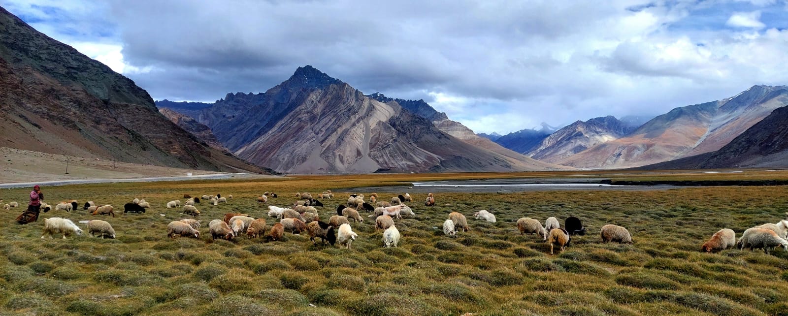
The Markha Valley trek is one of Ladakh’s most celebrated journeys. Traversing deep into Hemis National Park, the trail weaves between steep sandstone cliffs, traditional Buddhist hamlets, and windswept alpine pastures beneath the glaciated massif of Kang Yatse. Reaching its high point at Kongmaru La (5,200m), this route provides an incomparable foundation for aspiring high-altitude mountaineers.
Key Route Highlights
Day-by-Day Expedition Itinerary
Arrival in Leh (3,500m)
Mandatory acclimatization day at Spituk Basecamp HQ. Rest, hydration, and medical baseline check.
Leh Sightseeing & Acclimatization Hike
Gentle cultural walk to Shanti Stupa and Leh Palace to test cardiovascular adaptation at 3,600m.
Drive to Skiu, Trek to Sara (3,550m)
Scenic drive along the Indus-Zanskar confluence to Chilling/Skiu. Commence trekking along the Markha River.
Sara to Markha Village (3,700m)
Trek deeper into the canyon. Cross shallow river streams and arrive at Markha, the valley's largest settlement.
Markha to Hankar & Thochuntse (4,150m)
Ascend past Umlung monastery into high alpine terrain with dramatic initial views of Kang Yatse.
Thochuntse to Nimaling Plateau (4,720m)
Climb onto the high meadows of Nimaling. Shepherds graze yak herds beneath the towering walls of Kang Yatse.
Nimaling over Kongmaru La (5,200m) to Chokdo / Leh
Early morning crossing of Kongmaru La with staggering panoramic views. Descend through the red gorges of Shang to drive back to Leh.
Leh Basecamp Debrief & Forward Planning
Expedition debrief with your lead guides. Review your acclimatization response and plan your next 6,000m peak step.
Expedition Support & Inclusions
- Certified HAWS veteran expedition leader and licensed local guides
- High-altitude camping equipment (tents, sub-zero sleeping mats, mess dining)
- All meals, boiled drinking water, and trail nutrition
- Oxygen cylinder, Gamow hyperbaric bag support, and SpO2 monitoring
- Inner-line permits and Hemis National Park conservation fees